STB to Prepare EIS for Proposed Eagle Pass Rail Line (UPDATED)
Written by Marybeth Luczak, Executive Editor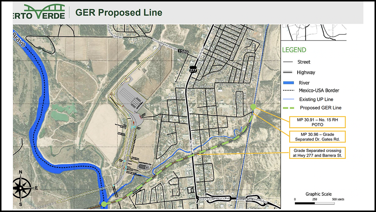
A map of Green Eagle Railroad LLC’s proposed 1.335-mile common carrier rail line in Maverick County, Tex., extending from the southern border of the United States and connecting to Union Pacific (UP) at approximately milepost 31 on the Eagle Pass Subdivision. The line is part of parent company PVH’s proposed trade corridor for freight and commercial motor vehicles extending into Mexico. (GER Map)
The Surface Transportation Board’s (STB) Office of Environmental Analysis on March 29 issued a Notice of Intent to prepare an Environmental Impact Statement (EIS) in connection with Green Eagle Railroad, LLC’s (GER) proposed construction and operation of an approximately 1.335-mile rail line in Maverick County, Tex., extending from the southern border of the United States and connecting to Union Pacific (UP) at approximately milepost 31 on the Eagle Pass Subdivision. Authorizations and permitting for the proposed project are also under way.


![“Thanks to Secretary Pete [Buttigieg], USDOT, the Federal Railroad Administration and all our partners for making the S-Line passenger rail a reality!!” NCDOT Secretary Joey Hopkins said in a July 1 LinkedIn post. “Thanks to the hard work of our NCDOT team we broke ground on the first construction project in the Raleigh to Wake Forest segment, a $19M project to grade separate Durant Road 7 months after the grant announcement!!” (Photograph Courtesy of Joey Hopkins)](https://www.railwayage.com/wp-content/uploads/2024/07/slinelead-315x168.png)